Longfellow Bridge
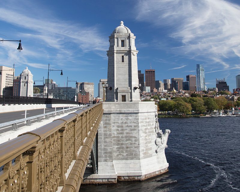
This historic granite bridge, connecting Boston and Cambridge, was completed in 1906 and features distinctive salt-and-pepper shaker towers.
View the ironwork details from a river cruise for clear sightlines.

The Charles River you walk along today bears little resemblance to the waterway that greeted colonial settlers. What began as a broad tidal estuary prone to flooding was radically re-engineered across three centuries, reshaping Boston's geography and creating the basin and parkland that now define the city's waterfront character.
Quick answer
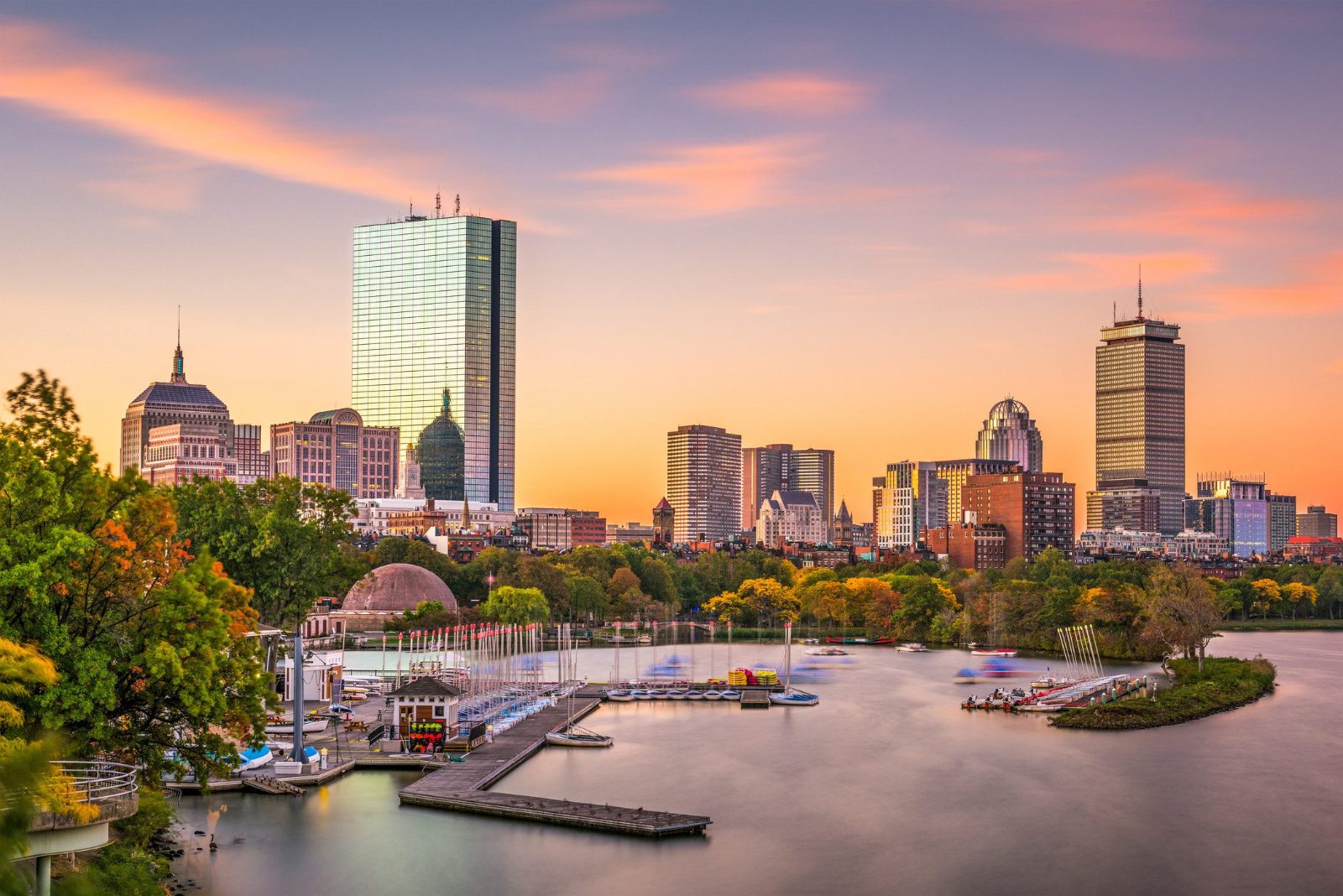
The Charles River's transformation began with colonial mills damming its lower reaches in the 1600s, accelerated with massive land reclamation between 1814 and 1882 that filled tidal flats to create the Back Bay neighborhood, and concluded with the 1910 completion of the Charles River Dam, which converted the tidal estuary into a controlled freshwater basin. The Esplanade parkland opened in phases from 1928 through 1949, establishing the recreational corridor visitors experience today.
In 1614, Captain John Smith charted a wide tidal river he called the Massachusetts, flowing through salt marshes where the basin now sits. Early colonists harnessed that tidal force—by the 1640s, watermill dams lined the lower Charles, grinding grain and sawing timber at sites from Watertown to the harbor mouth. The river's modern form emerged through deliberate intervention. Between 1814 and 1882, developers filled roughly 450 acres of Charles River tidal flats, pushing the shoreline outward to create Boston's Back Bay district and narrowing the waterway by nearly half its original width. Upstream, industrialists dammed the river at Waltham in 1814 to power textile mills, a pattern repeated at a dozen sites upriver, fundamentally altering the watershed's hydrology. The most dramatic change arrived in 1908 when construction began on the Charles River Dam at the river's mouth. Completed in 1910, the dam severed the Charles from tidal influence, transforming eight miles of brackish estuary into a stable freshwater basin and eliminating the twice-daily exposure of mudflats that had defined the riverscape for millennia. The engineering feat raised the water level permanently, drowning old wharves and reshaping the shoreline yet again. Landscape architect Arthur Shurcliff designed the Esplanade parkland atop newly stabilized banks, with initial sections opening in 1928 and major expansions following in the 1930s under public works programs. The Hatch Shell bandstand arrived in 1940, cementing the Esplanade's role as civic gathering space. Storrow Drive, built along the Boston shore between 1949 and 1951, completed the modern configuration—a constrained river channel flanked by continuous parkland and roadway, engineered for recreation and circulation rather than commerce or tidal rhythm. Today's Charles River basin operates as a managed hydrological system, its water level controlled by the New Charles River Dam completed in 1978, which replaced the 1910 structure. The waterway remains a focal point of Boston civic life, but the charles river boston history reveals a landscape wholly remade by human intention, bearing only topographic traces of the tidal estuary that once sprawled across the basin floor.
“The 1910 dam converted eight miles of tidal estuary into a controlled freshwater basin, erasing millennia of tidal rhythm in a single engineering stroke.”
For millennia the Charles River flowed as a tidal estuary, its brackish waters rising and falling twice daily across marshlands that stretched from present-day Watertown to Boston Harbor. Indigenous Massachusett peoples fished its banks and navigated its channels long before English settlers arrived in 1630. Colonial Boston knew the river as a working waterway, its shores lined with shipyards, wharves, and tanneries that dumped waste directly into the current. By the nineteenth century industrialization had transformed the lower basin into an open sewer, its odor notorious throughout the city. The first major intervention came in 1910 when the Charles River Dam was completed near the mouth of the river, converting the tidal estuary into a controlled freshwater basin. Engineer James Jackson oversaw the project, which installed locks to manage water levels and began the decades-long process of reclaiming mud flats for parkland. The Esplanade itself emerged in stages: landscape architect Arthur Shurcliff designed the original promenade in the 1930s, funded by philanthropist Helen Storrow, whose name now marks the parallel roadway. The Hatch Shell bandstand opened in 1940, replacing an earlier temporary structure and establishing the river's role as a civic gathering space. Flood control remained imperfect until 1978, when the New Charles River Dam replaced the 1910 structure with a modern facility featuring three locks and pumping stations capable of managing storm surges. This engineering allowed the Esplanade to expand further, adding lagoons, footbridges, and continuous pathways that now stretch nearly twenty miles upstream. Cleanup efforts accelerated after the federal Clean Water Act, though the river did not achieve swimmable status until intermittent periods in the twenty-first century. Today visitors walk paths where tidal marshes once flooded twice daily. The Longfellow Bridge, originally the Cambridge Bridge of 1793 and rebuilt in 1906, still spans the basin. Granite seawalls and Victorian gas lamps line sections of the Esplanade, remnants of the early twentieth-century vision to transform charles river boston history from industrial corridor to urban sanctuary. The river's evolution from estuary to engineered waterway remains visible in every controlled water level and reclaimed acre.
Indigenous Massachusett peoples fish and navigate the tidal Charles River estuary for thousands of years.
English Puritan settlers establish Boston and begin using the river for shipbuilding and trade.
The West Boston Bridge (later Longfellow Bridge) is rebuilt in stone, becoming a key crossing point over the tidal waters.
The Charles River Dam is completed, converting the tidal estuary into a controlled freshwater basin and enabling land reclamation.
The Charles River Esplanade is constructed under the design of landscape architect Arthur Shurcliff, funded by Helen Osborne Storrow.
The Edward A. Hatch Memorial Shell opens on the Esplanade, replacing a temporary bandstand and hosting public concerts.
The New Charles River Dam replaces the 1910 structure, featuring modern locks and pumps to manage flood control and water levels.
Federal and state cleanup efforts under the Clean Water Act gradually improve water quality, achieving intermittent swimmable conditions by the 2010s.
The Charles River serves as a living gallery of Boston’s historical evolution, marked by architectural landmarks that bridge the past and present. These sites reflect the industrial, cultural, and recreational history of the riverfront.
This historic granite bridge, connecting Boston and Cambridge, was completed in 1906 and features distinctive salt-and-pepper shaker towers.
View the ironwork details from a river cruise for clear sightlines.
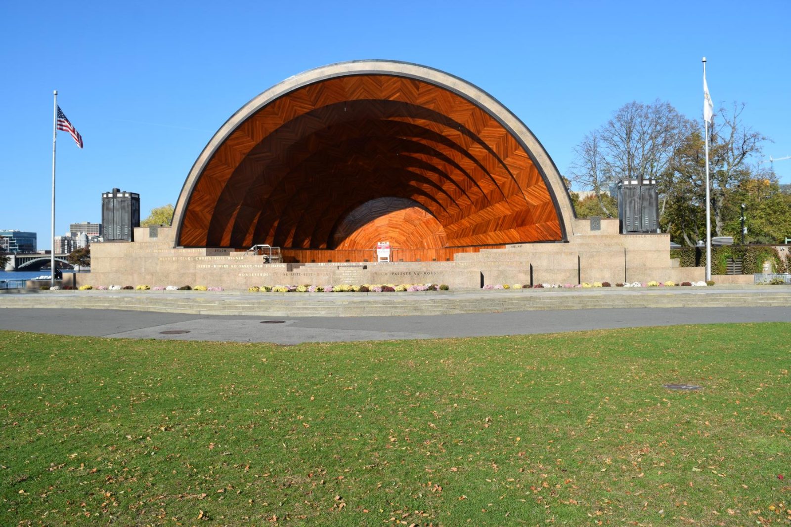
An outdoor concert venue commissioned in the 1930s, this structure is a staple of the Esplanade and a center for Boston’s musical history.
Walk the perimeter grass for the best angle of the stage.
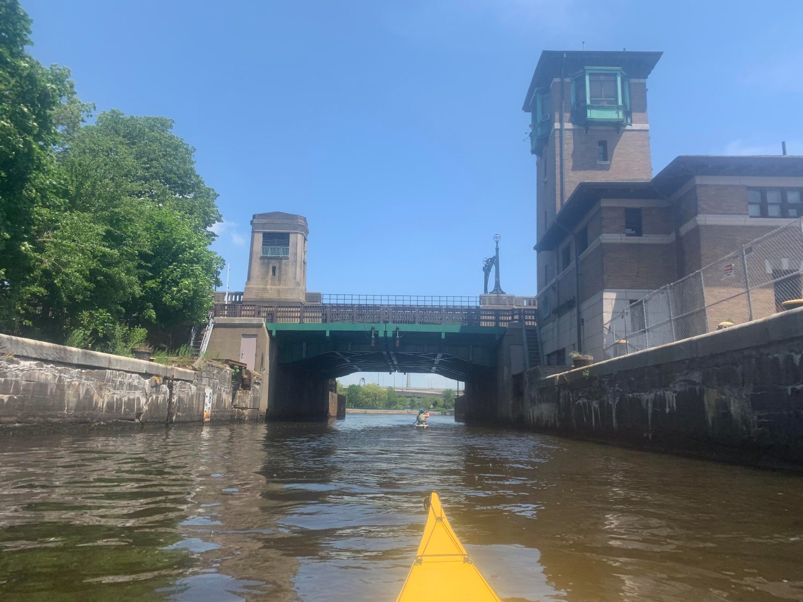
Built to control water levels and salinity, this infrastructure project transformed the river into the freshwater basin seen today.
Observe the locks from the pedestrian walkway nearby.

Founded in the 1940s, this site represents the democratization of river access and a long-standing tradition of local sailing.
Watch the sailboats from the pier during early morning hours.
The Charles River Esplanade remains accessible to the public throughout the week. Visitors can enjoy the riverfront areas at any time during the day or night.
The Charles River Esplanade is located at Charles River Esplanade, Boston, MA 02114, USA. The most accessible approach is via the MBTA subway system, which provides direct pedestrian access to the riverfront pathways.
MBTA Red Line to Charles/MGH Station
From Beacon Hill via the Fiedler Footbridge
MBTA Bus routes 43 or 55 to Charles St @ Pinckney St
To experience the area with lower crowds and optimal morning light, plan your arrival between 08:00–10:00. Use the Fiedler Footbridge for the most direct pedestrian access from the Beacon Hill neighborhood.
The best arrival window is 08:00–10:00, which offers the best morning light and lower crowds before the afternoon peak. This time provides a quiet environment to observe the riverfront and its surrounding historical landscape.
—
These hours are ideal for walking or cycling along the esplanade with few interruptions.
Mild with highs of 65°F–75°F.
Gardens are in bloom and the weather is comfortable for extended outdoor activity.
Cool with highs of 60°F–70°F.
The foliage changes color, providing clear views across the water and into the historic city center.
Warm with highs of 80°F–85°F.
This period sees increased pedestrian traffic and frequent river-based recreational activities.
Verdict: The best time to visit is weekday mornings between 08:00–10:00 during the months of May or October.
Everything you need to know about charles river boston history
Learning about charles river boston history provides valuable context for the city's growth, revealing how the basin evolved from a tidal estuary into a vibrant recreational space. Understanding this charles river boston history allows visitors to appreciate the engineering feats that shaped the modern shoreline.
The best time to explore the legacy of the river is during the morning window of 08:00–10:00, which offers soft light and fewer crowds. This schedule ensures a calm atmosphere to absorb the charles river boston history while enjoying the waterfront scenery.
There is no cost to access the park, as it is a public waterway with an entry fee of 0 USD. You are free to walk the paths and enjoy the landscape without needing any tickets.
Key landmarks in the area include the Hatch Memorial Shell and the Longfellow Bridge, both central to the narrative of Boston landmarks. These structures highlight the architectural evolution found throughout the local river story.
While this site focuses on the history of the area, you can easily find options to book a cruise or guided walk through our reservation portal. These excursions provide deeper insights into the maritime traditions and urban development of the region.
The Charles River Esplanade is located at Charles River Esplanade, Boston, MA 02114, USA, and is easily accessible by public transit or foot. Planning your arrival within the suggested morning window helps you avoid the heaviest traffic.
The park is a family-friendly destination, offering wide paths and open spaces ideal for children to walk and play. Many families enjoy the area as a peaceful retreat in the heart of the city.
The Esplanade remains open daily, operating from 00:00–23:59 to accommodate visitors at any time. This consistent schedule ensures you can visit whenever it fits your travel plans.